The Walker River Scenic Drive
The Walker River Scenic Drive is a remote drive located to the south of Yerington and the west of Hawthorne. This scenic drive passes through a pleasant mix of mountains, arid hills, a sprawling desert valley and grazing lands. The drive also closely follows the East Walker River for much of the drive.
The Walker River Scenic Drive is sixty miles long and follows gravel roads for its entire distance. The roads, although gravel, are generally in good condition and very wide. Other than the usual “washboards,” travelers should have no issue traveling down the roads beyond dusty conditions.
Beginning at the southern point on the California/Nevada border near Bridgeport Reservoir, the road initially follows Forest Road 28 for fifteen miles. During this stretch of the drive, the road closely follows the East Walker River as the river threads it’s way through the arid hills. As a warning, this section of the road can occasionally flood during spring run-off if snowpack levels are high.
After fifteen miles, the Walker Scenic Drive heads north toward Yerington. This stretch of road offers superb views of the Pine Grove Hills and the dominating Wassuk Range. Mt. Grant is the tallest mountain in the Wassuk Range and has an elevation of 11,239 feet. For those seeking adventure in the Wassuk Range, one word of warning – the area around Mt. Grant is part of the Hawthorne Army Ammunition Depot and is closed to public access.
There are no services of any kind along the route. Indeed, for much of the drive, there isn’t anything at all as the drive passes either through National Forest or Bureau of Land Management lands. The only development on the drive occurs near the northern point of the drive, where the route passes by a number of ranches.
Although there are no services or lodging on the drive, the traveler can pick up supplies and find a hotel in the towns of Yerington or Hawthorne. Additionally, camping spots are abundant. For the first forty miles of the drive heading north toward Yerington, the route passes through federal lands, allowing for camping virtually anywhere. Moreover, as the drive follows the East Walker River, there’s quite a few “nice spots” to pull over and do some primitive camping.
Overall, anyone heading down Highway 395 to/from the east entrance to Yosemite National Park should take the time to explore this enjoyable scenic drive.
Quick Facts About the Walker River Road Scenic Drive
- Trip Length : 60 miles, one-way. The route follows the E. Walker Road and Forest Road 28.
- Road Type - The road is gravel for its entire distance. The road is generally wide and in good condition, although some rough spots do exist.
- RV's / Campers? - Yes.
- Services Available - Gas and supplies can be found in Yerington and Hawthorne.
- General Location - West-central Nevada, to the south of Yerington and the west of Hawthorne. Southern point of drive begins just across the CA/NV border, near Bridgeport Reservoir.
- Camping - Drive passes through BLM and forest service lands for much of its distance, so primitive camping is allowed everywhere. One or two developed campgrounds also exist on side roads, although they tend to be a good 10+ miles away from the scenic drive itself (look for signs).
Map of the Walker River Road Scenic Drive

|
Suggested Books
 |
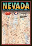
Benchmark Nevada Road & Recreation Atlas : This topographic map book shows ALL roads in Nevada. This book is a mandatory requirement if you'll be venturing off the main highways shown on the tourist map. Additionally, this book shows many historical sites, points of interest and recreation areas.
More Info at Amazon
|
|
Where to Stay
There are no services along the Walker River Road, but there's plenty of both developed and undeveloped camping available. Additionally, several small hotels are located in Hawthorne and Yerington. |
Related Articles & Information on Exploring Nevada
|
Copyright © 2007 - 2025 Exploring Nevada.Com
|
|
|

